Cerro Tanaro
Last update 30 January 2024
Cerro Tanaro, journey to the (geographical) center of Monferrato
Landscape
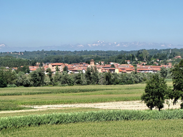
Cerro Tanaro lies in the High Monferrato.
It is about 15 km from Asti, the provincial capital.
History
The first historical references about Cerro Tanaro date back to the 12th century.
The town underwent several dominations throughout history.
The most important ones are those of the Marquises of Monferrato and the Savoys.
Administration
Cerro Tanaro is the seat of the Comunità Collinare Via Fulvia.
Food and wine and typical products
Cerro Tanaro is a town with a strong wine vocation.
Typical wines of the territory are Grignolino, Barbera, and Freisa.
To be seen
The parish church dedicated to St. John the Baptist is the most significant monument in the area.
A short distance from the parish church, we find the Church of the Confraternity of the Holy Trinity (Chiesa della Confraternita della Santissima Trinità).
The medieval castle, now a private residence, hosted feudal lords, princes, and lords.
Worthy of note, in the center of the village, is the stronghold (privately owned) called Adorni Tower — Turret (Torre degli Adorni — Torretta).
In Piazza Libertà stands the town hall.
The Sarachet Bicycle Museum (Museo della Bicicletta Sarachet) is located at the Rocchetta Tanaro-Cerro railway station.
Insights
“Punti di Interesse”. Comune di Cerro Tanaro, www.comune.cerrotanaro.at.it/it/point-of-interests. Last accessed Jan. 24, 2024.
Curiosity
Cerro Tanaro is considered the geographic center of Monferrato.
Data source
- Synthesis / reprocessing information taken from the institutional website (current and previous versions) of the Municipality of Cerro Tanaro — https://www.comune.cerrotanaro.at.it/
- Cover image source: Municipality of Cerro Tanaro — https://www.comune.cerrotanaro.at.it/
Insights
BeWeb - Beni Ecclesiastici in WEB
https://beweb.chiesacattolica.it/
Catalogo Generale dei Beni Culturali
https://catalogo.beniculturali.it/
Centro Interuniversitario di Storia Territoriale "Goffredo Casalis"
https://www.archiviocasalis.it/
Ente Turismo Langhe Monferrato Roero
https://www.visitlmr.it
Wikipedia, l'enciclopedia libera.
https://it.wikipedia.org
- Cerro Tanaro
https://it.wikipedia.org/wiki/Cerro_Tanaro
See also
News from Cerro Tanaro
- Discover the latest news posted on the website of the Municipality of Cerro Tanaro
https://www.comune.cerrotanaro.at.it/it/news
Events in Cerro Tanaro
- Discover the events posted on the website of the Municipality of Cerro Tanaro
https://www.comune.cerrotanaro.at.it/it/events

